It’s well-known in the Cowichan Lake area that it’s hard to keep a conversation moving once the idea of raising the Cowichan Lake weir is mentioned.
This was the case during a Cowichan Watershed Board public meeting at the Cowichan Lake Education Centre, Thursday, April 7.
During the event’s first presentation, by erosion specialist Eric Morris, the presenter made mention of raising the weir in relation to the effect it would have on overall erosion.
“If you change the water level you’re going to change the mean shoreline and shift it,” he said, adding that erosion will take place in order to establish a new equilibrium.
“The weir raising is relatively small to the existing weir, but there will be some re-shaping to the shoreline.”
Overall, raising the weir would have a small impact upon the shoreline compared to some other factors.
During his presentation, Morris revealed that he had travelled around the entire Cowichan Lake shoreline in September, when water is the lowest.
In his travels and research, Morris concluded that Honeymoon Bay and Youbou shoreline erosion is mainly the fault of residents who have built seawalls (rocks or cement on the shore to prevent erosion at that location) and groynes (docks or barriers pointing out into the lake; also to prevent erosion at a particular location).
“Erosion occurs when sediment budget is not balanced,” he explained. “A sea wall will disturb the cross-wall transport.”
A groyne may prevent erosion on one side, but that side will also collect more sediment, while the other erodes away.
Log boom removal has also resulted in erosion in the Honeymoon Bay area.
Second-most at fault for erosion in Honeymoon Bay, and Youbou, and tied with most to blame for erosion at Gordon Bay Provincial Park and Spring Beach, is vegetation removal, followed by vessel traffic.
Although the Cowichan Lake weir is in most locations the least to blame for erosion, a comment from the audience following Morris’s presentation was that the weir shouldn’t be fussed with. Taking into account all of these other things that are eroding the shoreline, adding the raising of the weir into the mix – a factor that we can control – is asking for trouble.
“I agree,” Morris said. “It’s a fair comment.”
If the weir were to be raised, Morris suggested that monitoring stations be put in place to measure the weir’s effect.
But, why was the raising of the weir even being discussed, with such a strong opposition from members of the public who attended the meeting?
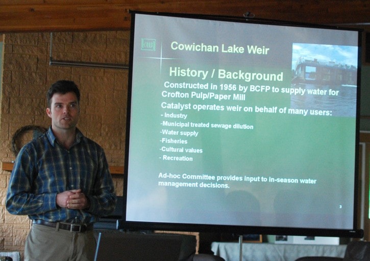
It’s because of the users downstream, Watershed Board representative Rodger Hunter explained. They need water downstream, and local sewage systems require at least seven cubic meters per second of flow from the Cowichan Lake into the Cowichan River to properly dilute their runoff.
“It needs that dilution flow to meet their target when it comes to that pollution level,” presenter and weir expert Craig Sutherland said during his presentation, later on in the meeting.
Since 1984, inflows into Cowichan Lake have reduced by 30 per cent.
“The inflows over the last decade have gone even lower,” Hunter said. “Things are changing, so we can’t stick to historical levels.”
A while back, the idea of raising the weir was deferred until a number of tests had taken place, of which the erosion study Morris has recently completed is but one.
“Any weir change would require further study,” Hunter explained. “That’s a ways off.”
Sutherland’s presentation on the weir’s rule band/rule curve approach to managing summer water levels, came next.
Throughout the summer, the Cowichan Lake weir ramps down its control gates in order to ensure the Cowichan River has enough water flowing into it for the dry summer. This is the rule curve approach, wherein the weir is lowered at a steady rate to allow a required minimum flow of seven cubic meters per second, treating Cowichan Lake like a bathtub.
Without having to raise the top of the weir, the rule band approach is similar to the rule curve approach of ramping down the weir, but provides more flexibility throughout the year, with a larger range with which the weir can be raised or lowered within its current range.
“Providing that extra little bit of storage gives us a little bit more assurance,” he said.
The weir remains off-control throughout the winter, as during this time of year there is plenty of precipitation to fill both the Cowichan Lake and River.
Typically, the weir is put back on control by the beginning of April, but Sutherland said that this has been postponed due to a particularly wet spring.
Following a couple more presentations, including one on the Cowichan Watershed Board’s many broad future goals, the meeting came to a close.
The group’s next meeting will take place Thursday, May 5, in either North Cowichan or Duncan.
As the location and time is finalized, it will be posted online, at www.cowichanwatershedboard.ca.