Property owners around Lake Cowichan will be able to get a look at what impact a new weir will have on their shoreline at an online community meeting scheduled for Wednesday, Nov. 17 at 7 p.m.
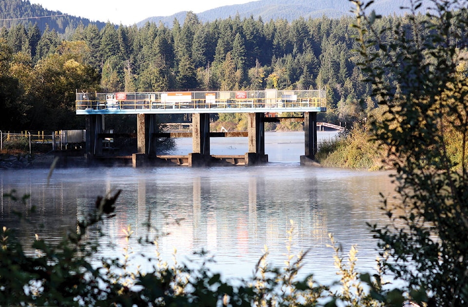
An assessment of the shoreline of the lake is now underway, as the new weir design for Cowichan Lake has been finished.
There has been a call to raise the level of the weir for many years, as droughts have endangered the flow of the river and everything downstream that depends on it, including salmon and other fish, drinking water, animal habitats and the Paper Excellence pulp and paper mill at Crofton.
Some recent years have been so dry, and the water level so critically low, that water has had to be pumped from the lake over the existing weir to feed the river.
The new weir will be 70 centimeters higher than the old one. It will allow more water to be captured in early spring and released in a controlled manner through the dry summer and fall months.
But the project, being led by the Cowichan Valley Regional District, has not been without controversy. Some Cowichan Lake property owners have feared that a new, higher weir will result in property loss through flooding.
“Our data collection to date is helping us understand the current status of the lakeshore and what types of impacts might happen with increased water storage. and we will be sharing the current mapping information with the public in a virtual presentation,” said Leroy Van Wieren, project manager for the Weir and Shoreline Assessment project. “The scope of this part of the project is primarily meant to understand potential impacts at the property level, and we hope property owners and anyone else interested in this work will tune in to learn more.”
As part of the presentation, the project team will be previewing a ‘Property View Tool’ which will enable property owners to see a map of their property and how different lake levels may affect their land, said a press release for the event. These levels will include the low-water mark, property title boundaries, existing weir elevation, new weir elevation, average high-water mark, a one-in-200 year flood line, and the present natural boundary. A modelled future natural boundary based on both additional water storage in the spring and summer as well as impacts from climate change is expected to be complete by February 2022.
“This project is a key step in our continuing effort to achieve climate resiliency for the Cowichan watershed,” said Kate Miller, manager of Environment Services with the CVRD. “The low water scenarios we’re experiencing have seen riparian vegetation drying up, reduced fish habitat, and tributaries sitting relatively higher and impacting aquatic access. This project is critical to ensure we are able to meet the community, environmental and economic needs of the future.”
Both the shoreline assessment and the design of the new weir are steps towards construction.
Anyone interested in attending can visit www.cowichanlakeweir.ca for login and call-in details, or to learn more about this phase of the weir project.