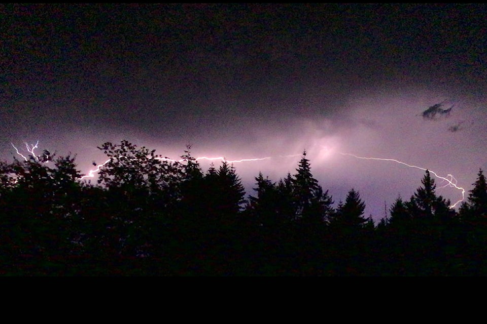
The Cowichan Valley and much of southern Vancouver Island were treated to a rare spectacle on Sunday evening as forked lightning danced across the skies and thunder shook buildings.
It’s believed the lightening sparked at least 12 spot fires in the region covered by the Coastal Fire Service, including one near Lake Cowichan at Meade Creek and one near Mount Hayes, close to Ladysmith.
The CFS’s Dorothy Jacobsen said the fire at Meade Creek was 2.4 hectares in size as of Monday morning and was burning out of control.
She said the fire at Mount Hayes was much smaller, at just a few acres, as of Monday morning and was also considered out of control.
RELATED STORY: B.C.TEEN’S HORSE KILLED BY LIGHTNING IN THUNDERSTORM
“Fire crews are attending to these fires and more information will be released as it is available,” Jacobsen said.
“We’re still getting in reports, but we know of a least 12 spot fires in the area of the Coastal Fire Service that we believe were sparked by the lightening from the storm.”
Environment Canada said approximately 1,600 lightning strikes occurred across southern Vancouver Island, the Sunshine Coast, and the western parts of the Lower Mainland during the storm, which began Sunday evening and ended early Monday morning.
Meteorologist Armel Castellan acknowledged that electrical storms of such intensity are rare for this area.
He said the storm occurred due to instability in the atmosphere as the high-pressure ridge of warm air that caused the weekend’s heat wave began to break down, which caused lot of buildup of energy in the lower atmosphere.
Castellan said as the higher levels in the atmosphere cooled, the destabilization caused high-level thunderstorm clouds to develop.
RELATED STORY: PUMPS NOT NEEDED ON THE COWICHAN RIVER THIS YEAR
He said the resulting storm wasn’t technically one with dry lightning, which occurs when the lower atmosphere is dry and precipitation evaporates before it reaches the ground, as many communities on the southern portion of Vancouver Island had some showers, although not as heavy as seen in many other electrical storms in the area.
“It was a pretty rare event, and it did cause some fires,” Castellan said.
“The weather system that broke down and caused the electrical storm broke some heat records, but while temperatures in North Cowichan were recorded at 33.7 C at their highest on Sunday afternoon, we haven’t had weather stations there long enough to determine if that was a record. But the temperature in Lytton, located in the interior, hit 41.2 C on Sunday, which was a record for that community.”
Castellan said it’s expected that temperatures in the Valley will become more seasonal, between 22-24 C, as the week progresses, and showers are forecast for late Thursday into Friday.
“We’re getting back to a wetter weather pattern, but we won’t likely see an enormous amount of rain,” he said.
“The average rain for the Valley in August is about 30 millimetres and we’ve had about 12 so far. We expect to see another 10 to 12 millimetres by the end of the week so we’re already getting close to the average precipitation this month. Last year, we received only about eight millimetres for the whole month.”
robert.barron@cowichanvalleycitizen.com
Like us on Facebook and follow us on Twitter